Craney and Neil won the A, see Craney's blog (he's my hero)
8 comments:
Anonymous
said...
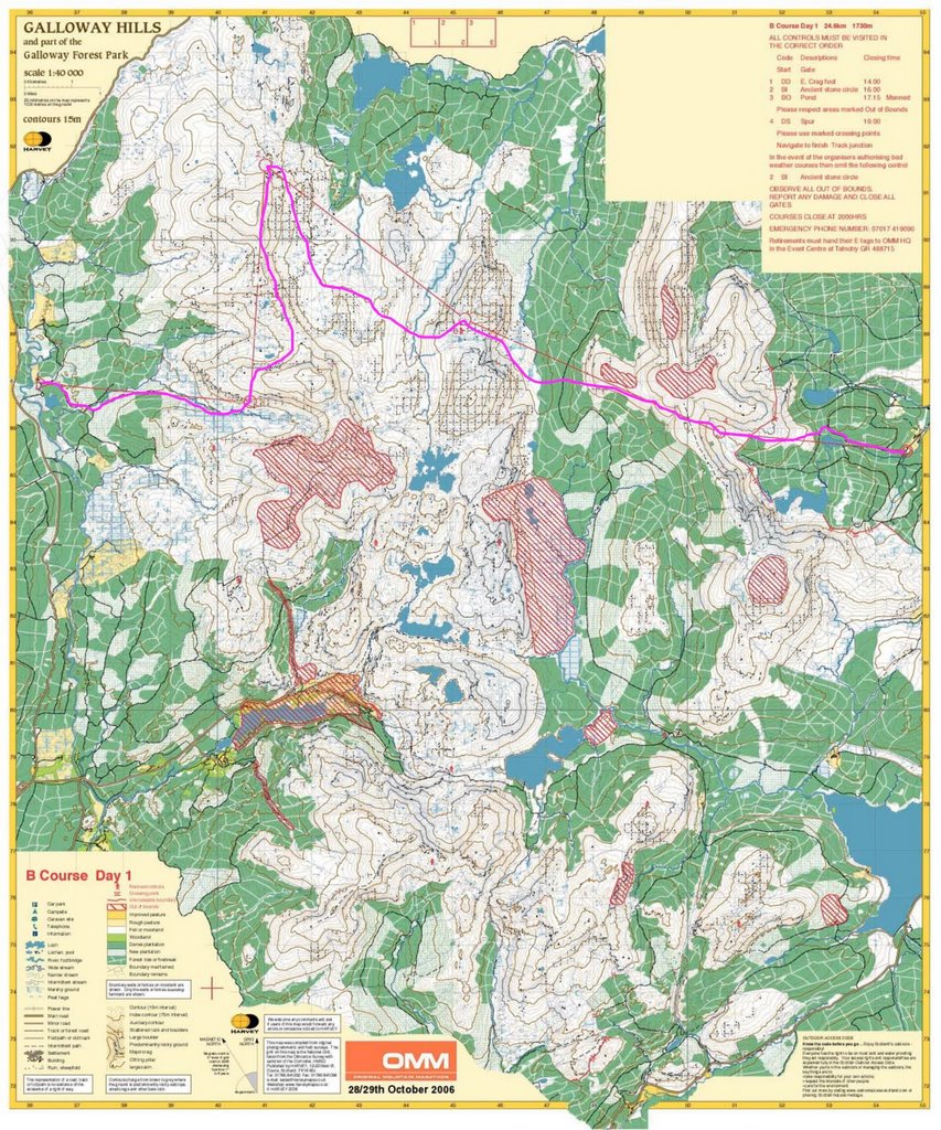
Congratulations! Great description of race, terrain and weather in previous blog. Would have been nice if you had marked your route choice on the maps, even if , as you say, there were not many options.
If you have Google Earth installed (free for download and highly recommendable), you can download our routechoices from here: http://student.umb.no/~orientering/arkiv/OMM2006.kmz
Seem like we lost some time choosing forest tracks both day 1 (ctrl 4) and day 2 (ctrl 3), but my rather short-legged better half didn't come to any agreement with the tussocks...wouldn't had a chance coming close to you two anyway.
Nice maps ji. Looks like we took much the same route as you on the first day although over the top of the second hill to 2, straighter across the open to 3 (using the unmarked track round the forest) and up the nice path on the other side of the plantation to 4.
On day 2 we were closer to gg's route though without the wobble on 2, going past the lake on the route to 4 and then contouring lower on the way to 5.
Having missed the chase and starting late we had the benefit of the elephant tracks or were these from the previous day?

8 comments:
Congratulations!
Great description of race, terrain and weather in previous blog. Would have been nice if you had marked your route choice on the maps, even if , as you say, there were not many options.
If you have Google Earth installed (free for download and highly recommendable), you can download our routechoices from here:
http://student.umb.no/~orientering/arkiv/OMM2006.kmz
ooh adventurous planning on day 2 - number 4 is slightly offset from the straight line to 5!
i will put our routes up now
really cool routes with google earth though!
Seem like we lost some time choosing forest tracks both day 1 (ctrl 4) and day 2 (ctrl 3), but my rather short-legged better half didn't come to any agreement with the tussocks...wouldn't had a chance coming close to you two anyway.
By the way, I've now included your route in blue (where it differs from ours) in the above mentioned Google Earth view.
think our route to 6 on day 2 was a mistake though... lost way too much height
Nice maps ji. Looks like we took much the same route as you on the first day although over the top of the second hill to 2, straighter across the open to 3 (using the unmarked track round the forest) and up the nice path on the other side of the plantation to 4.
On day 2 we were closer to gg's route though without the wobble on 2, going past the lake on the route to 4 and then contouring lower on the way to 5.
Having missed the chase and starting late we had the benefit of the elephant tracks or were these from the previous day?
Post a Comment